I first found out about this trail from this blog: David on Formosa – Hiking on the historic trail
Walking in Kent was our favourite activity in England. We love this guide book, Walking in Kent (Kev Reynolds), given by T’s aunt. 40 circular walks in Kent and I think we did about a quarter of them – some required access with your own vehicle. Even so, the train system in England was quick, convenient and played an important part in these awesome weekend walks.
After reading David’s blog about Caoling Historic Trail (草嶺古道), I found more information on the internet about it (mostly other blogs) and some route maps.
- Here is an article about it in the Taipei Times – The Beaten Trail.
- A blog in Chinese (Trad) about the trail – 台灣走透透:草嶺古道.
- A blog post about it on Life’s TAIWANderful.
- A photo blog about it on The Daily Bubble Tea.
- Lastly, the webpage on Taiwan’s tourism website.
On our last weekend in Taiwan, we were getting some nicer weather. So, we decided to do an early hike on Sunday so that we would have the rest of the day to do other stuff.
We took an early train from Taipei Main Station – had no trouble getting tickets at that time on a Sunday. Although, there were still a lot of people on the train (seemed like they were heading to Hualien).
We arrived in Fulong Station (福隆火車站) shortly before 9 AM. We took a side entrance and headed to the visitor centre.


About the Art Robots:
“The sculpture was created by the Taipei Railway Workshop of the Taiwan Railway Administration … assembled discarded wheels along with pistons, cylinders, and other parts from engines of diesel-electric locomotives and welded them into these Art Robots.”
The visitor centre was a very short walk from the train station. We didn’t realize it opened at 9 AM and neither did a group of tourists (waiting outside). We wanted to see if there were other information they could give us about the walk.

We spent our waiting time looking around the building and found this pretty useful map:

The guide at the visitor centre told us it would be easier to hike on the road instead of through the tunnel and onto Huzishan Bikeway because it had rained during the week. So, we took his advice.
9:00 We left the visitor centre with a backpack full of water, snacks and two rain jackets.
Before doing this hike, make sure you have:
- Enough water to last 3-4 hours; the hike is 8.5 km and this is from train station to train station.
- Food. No place to buy food or water until you reach the end.
- Good walking shoes. You will definitely be climbing (stairs).
- Walking companion(s).
It took about 40 minutes to walk to the start of the trail. It wasn’t a pleasant walk, I won’t lie. We were walking on paved roads most of the time and constantly watching out for trucks, cars, and scooters. Not sure if biking would have been easier. Anyway, we walked on the main road then turned left after a gas station and met up with part of the Huzishan Bikeway.
The hike was well-signed. No chances of getting lost.


Around 10:00 Yuanwangkeng Waterfront Park. Nice, peaceful place. We were joined by some fellow hikers. Shortly after this we saw a sign for Caoling Historic Trail (see below).
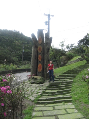
We thought this was the start of the trail. But, nope!

More paved roads to the start of the trail. At least the walk on these roads was nicer because there were less cars and prettier scenery. Such as this:

And finally, we reach the beginning of the trail.
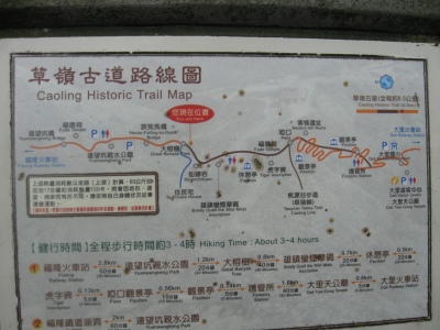
Although, somehow we missed the “Horse-Falling-To-Death” bridge (跌死馬橋).
About the Caoling Historic Trail:
- It is a remaining part of the original Danlan Historic Trail (淡蘭古道).
- In the Qing Dynasty this trail was the only link from Taipei to Yilan coast.
Source: Yilan’s Cultural Affairs Bureau webpage on Caoling Historic Trail

We were both fairly out of shape. I wasn’t biking at all in the winter – can’t stand the cold. It was a good hike, though. It was nice to get out of the city and immerse ourselves in nature. I loved how convenient it was to hike in England and same in Taiwan. If only Ontario was the same…

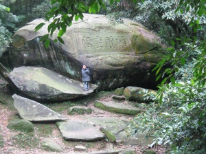
10:45 We reached the “Boldly Queill the Wild Mists” inscription (雄鎮蠻煙摩碣).
About the inscription:
- Located at an elevation of 240m above sea level.
- From the Qing Dynasty (Tongzhi era).
- Because this area was often misty and foggy, making it hard to navigate, Liu Ming-Deng wrote these words to help suppress the fog (and help them navigate).
- This is now rated as a level 3 historic site (I am not entirely sure what this means).
Source: 虎字碑、雄鎮蠻煙碑.三級古蹟


11:05 We reached the location of the Tiger Inscription.
About the Tiger Inscription:
- In 1867, Taiwan Regional Commander Liu Ming-Deng arrived at the Caoling Pass for an inspection of Northern Taiwan and encountered strong wind and thick fog; he couldn’t navigate.
- He then inscribed the character “Tiger” to suppress the wind – according to a Chinese saying: Clouds obey the dragon, wind obeys the tiger (雲從龍,風從虎).
- Legend has it that Liu Ming-Deng liked writing the character for Tiger and that his calligraphy indicated a difference in gender. The Tiger character on this stone is female (whereas the “male” Tiger is in Taipei, on Boai Road).
- Also a level 3 historic site.

11:10 We reached the Pass Pavilion. If you take a right from this Pavilion, you can go to Daxi. Since we wanted to do a shorter walk, we took a left to Dali.


11:20 We left the pavilion, heading toward Dali.
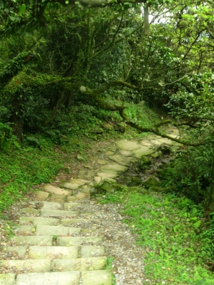
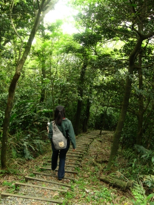
We decided to take the “path” instead of the paved roads. It was harder to walk on (by this time our legs were fairly sore) but it was prettier.
11:40 We reached the inn ruins.

Lu house (盧宅; Reed House) is on the way from the saddle of Caoling Ancient Trail to Dali Tian-gong Temple of Heaven Ruler. In Qing Dynasty, Reed House was a resting place for travellers to Yilan or back to Taipei. With no other houses around this area, Reed House used to be an important tavern on the trail. After the owner passed away and the importance of the trail decreased, the descendants no longer provided the lodging. Today the ruins are the only things left for people to visit and ponder.
11:50 We passed by the forestry office.
Shortly after that, we were given the option of continuing on our path or taking the scenic route (600 m). Of course, we took the scenic option, not knowing it involved more uphill climbing.

12:30 We reached the temple (Tiangong Temple 天公廟).
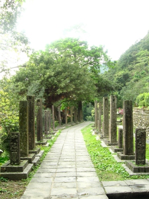

Here you will find water, washrooms and the Dali Visitor Centre.
12:50 We finally made it to Dali station (大里火車站). We had to wait half an hour or so for the next train.

